
Introduction
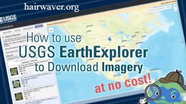
USGS EarthExplorer is a free online platform developed by the United States Geological Survey that gives you access to millions of satellite images, aerial photographs, and geospatial datasets from around the world. Whether you are a GIS analyst, a student, a researcher, or simply someone curious about remote sensing, this tool opens up a massive archive of Earth observation data at no cost.
In this article, you will learn exactly what EarthExplorer offers, how to use it step by step, how to download images, how to find Landsat data, and everything else you need to get started with confidence.
What Is USGS EarthExplorer?
USGS EarthExplorer is a web-based data portal maintained by the United States Geological Survey. It serves as the primary gateway to the USGS Earth Resources Observation and Science Center archive. That archive holds decades of satellite imagery, aerial photography, radar data, and elevation datasets collected from sources including Landsat, Sentinel, MODIS, and many others.
Think of it as a search engine, but instead of web pages, you are searching for satellite images tied to specific locations and time periods. You can filter results by date, cloud cover, sensor type, and geographic area. The platform is widely used in fields like environmental monitoring, urban planning, agriculture, disaster response, and academic research.
I have used EarthExplorer myself for land cover analysis projects, and once you get the hang of the interface, it becomes one of the most powerful free tools in any GIS toolkit.
Is USGS EarthExplorer Free?
Yes, USGS EarthExplorer is completely free to use. You do not need to pay for access to the platform or for most of the datasets it hosts.
Here is what you get for free:
- Access to the full USGS satellite imagery archive
- Landsat 1 through Landsat 9 imagery going back to 1972
- Aerial photography from the National Agriculture Imagery Program
- Shuttle Radar Topography Mission elevation data
- Sentinel 2 and other international satellite datasets
- Digital elevation models for terrain analysis
The only thing you need is a free USGS account to download data. Browsing and previewing imagery requires no account at all. There are no subscription fees, no hidden charges, and no limits on how much you can search. For remote sensing professionals and students alike, this is genuinely one of the best free resources available anywhere.
How Do I Use USGS EarthExplorer?
Using USGS EarthExplorer is straightforward once you understand its basic workflow. The platform works in three main stages: define your area of interest, select your dataset, and filter your results.
Step 1: Create a Free Account
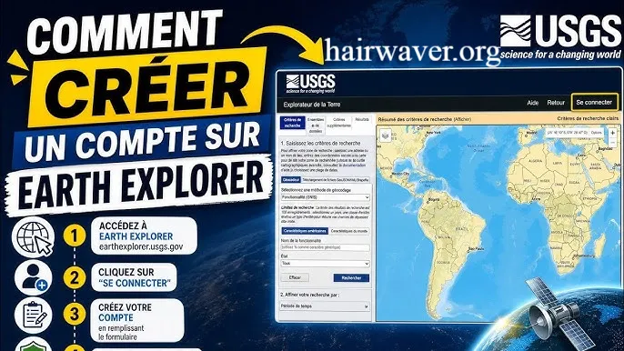
Before you can download anything, you need to register for a free USGS account. Head to the EarthExplorer website and click the Login button in the upper right corner. Select the option to create a new account. Fill in your details and verify your email. The whole process takes about five minutes.
Step 2: Define Your Search Area
Once you are logged in, you will see a map interface on the left and a search panel on the right. You have several options for defining where you want to search:
- Type in a place name or coordinates in the address search bar
- Use the map to manually zoom into your area of interest
- Draw a polygon or rectangle directly on the map
- Upload a KML or shapefile to define a precise boundary
Choose the method that works best for your project. For most users, typing in a city name or drawing a box on the map is the quickest approach.
Step 3: Set Your Date Range
Below the search area options, you will find a date range filter. Enter your start and end dates. If you are looking for imagery from a specific season or year, this is where you narrow it down. You can also filter by cloud cover percentage, which is especially helpful for optical satellite data.
Step 4: Select Your Dataset
Click the Data Sets tab at the top of the search panel. You will see a long list of dataset categories. These include:
- Landsat Collection 2 (the most popular category for multispectral imagery)
- Sentinel 2 data
- Aerial imagery
- Radar datasets
- Digital elevation models
Expand any category by clicking the arrow next to it. Check the box next to the specific dataset you want to search.
Step 5: Apply Additional Filters
Click the Additional Criteria tab to refine your results further. Depending on the dataset, you may be able to filter by cloud cover, processing level, or sensor type. These filters help you avoid cluttered or unusable scenes.
Step 6: Run Your Search
Click the Results button at the bottom of the panel. EarthExplorer will display all matching scenes in a list on the left side of the screen. Each result shows a thumbnail, scene ID, acquisition date, and cloud cover percentage. Click on any result to highlight its footprint on the map.
How Do I Download Images from EarthExplorer?
Downloading satellite imagery from USGS EarthExplorer is simple once you find the scene you want.
Follow these steps:
- Run your search and browse the results as described above
- Find the scene you want to download
- Click the download icon, which looks like a small arrow pointing downward, next to the scene
- A window will pop up showing available product options for that scene
- Choose the product type you need. For most users, the Level 2 Science Product or the GeoTIFF bundle is the right choice
- Click Download and the file will begin saving to your computer
Some scenes are available for immediate download. Others require a request, and the file will be staged and emailed to you within a short time. Landsat data is almost always available immediately.
What File Formats Will You Get?
Most satellite data from EarthExplorer downloads as GeoTIFF files. These are georeferenced raster images that work directly in GIS software like QGIS, ArcGIS, and ENVI. Elevation data often comes in a similar format. Aerial photography may download as JPEG 2000 or TIFF files depending on the source.
How Do I Find Landsat Images in EarthExplorer?
Landsat is the most widely used satellite program in the EarthExplorer archive. Here is the quickest way to find exactly what you need.
Navigating to the Landsat Dataset
After defining your search area and date range, click the Data Sets tab. Look for the category labeled Landsat. Expand it and you will see several subcategories:
- Landsat Collection 2 Level 1 (raw digital numbers)
- Landsat Collection 2 Level 2 (surface reflectance, atmospherically corrected)
- Landsat Legacy datasets going back to early missions
For most modern applications, Landsat Collection 2 Level 2 is the best choice. It gives you atmospherically corrected data that is ready for analysis without extra preprocessing steps.
Tips for Getting the Best Landsat Results
- Set your cloud cover filter to 10 percent or lower for clear imagery
- Use date ranges that match your season of interest for land cover studies
- Choose Landsat 8 or Landsat 9 for the highest resolution and most recent data
- Use the compare tool to visually check multiple scenes before downloading
Landsat imagery has a spatial resolution of 30 meters per pixel for most bands. It is ideal for regional to global scale studies involving vegetation, water bodies, urban expansion, and land use change.
Why EarthExplorer Matters for GIS and Remote Sensing
The data available through USGS EarthExplorer supports some of the most important environmental work happening today. Scientists use it to track glacier retreat, monitor deforestation, assess flood damage, and study drought conditions. Urban planners use it to measure city growth over decades. Farmers use aerial photography to analyze field conditions.
For students and beginners in GIS and remote sensing, EarthExplorer is the perfect starting point. The data is free, the archive is enormous, and the platform teaches you how satellite data is organized and accessed in a professional setting.
Conclusion
USGS EarthExplorer is one of the most powerful free tools available for anyone working with satellite imagery, aerial photography, elevation data, or remote sensing in general. It gives you access to a global archive spanning more than five decades. It costs nothing. And with a bit of practice, it becomes an indispensable part of any spatial data workflow.
Whether you are downloading your first Landsat scene or pulling historical aerial imagery for a research project, EarthExplorer has what you need. Give it a try, explore the datasets available for your area, and see what you discover.
Have you used USGS EarthExplorer before? Share this article with a colleague who is just getting started with GIS or satellite data, and help them skip the learning curve.
Frequently Asked Questions
1. What is USGS EarthExplorer used for? It is used to search and download satellite imagery, aerial photographs, elevation data, and other geospatial datasets for research, GIS projects, environmental monitoring, and remote sensing applications.
2. Do I need an account to use EarthExplorer? You can browse and preview data without an account. However, you need a free USGS account to download any datasets.
3. What types of satellite data are available on EarthExplorer? EarthExplorer hosts Landsat, Sentinel, MODIS, ASTER, aerial photography, radar data, and digital elevation models among many others.
4. How far back does the EarthExplorer archive go? The archive includes data going back to 1972, when the first Landsat satellite began collecting imagery.
5. What is the spatial resolution of Landsat data on EarthExplorer? Most Landsat bands have a spatial resolution of 30 meters per pixel. The panchromatic band on Landsat 8 and 9 has a resolution of 15 meters.
6. Can I use EarthExplorer data for commercial projects? Yes. Most USGS data is in the public domain and can be used for both commercial and noncommercial purposes without restriction.
7. How long does it take to download data from EarthExplorer? Landsat and many other datasets download immediately. Some older or less common datasets may be staged and delivered via email within a few hours.
8. What software do I need to open EarthExplorer files? GeoTIFF files from EarthExplorer open in QGIS, ArcGIS, ENVI, Google Earth Pro, and many other GIS and remote sensing applications.
9. Can I search EarthExplorer by coordinates? Yes. You can enter decimal degree coordinates directly in the search panel to define your area of interest.
10. Is EarthExplorer the same as Google Earth? No. Google Earth is a visualization tool. USGS EarthExplorer is a data portal where you search and download raw satellite and aerial datasets for analysis in GIS software.
About the Autho: James Carver is a GIS specialist and geospatial data writer with more than a decade of experience in remote sensing, land use analysis, and spatial data management. He has worked on environmental monitoring projects across North America and Southeast Asia, using tools like QGIS, ArcGIS, and Google Earth Engine. James writes to make complex geospatial concepts accessible to students, researchers, and professionals who are just beginning to explore the world of satellite data.
email: johanharwen@314gmail.com
Author Name: James Carver